



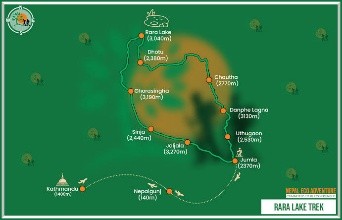
Project Overview Hallmark Consultants conducted a Detailed Engineering Survey and Alignment Mapping for the 8 km trekking trail connecting Talcha Airport to Rara Lake. The project aimed to establish a safe, accessible, and environmentally sustainable eco-tourism corridor in high-altitude terrain.
Key Project Details
-
Client / Partner: Tourism Infrastructure Development Project (TIDP) / Ministry of Culture, Tourism and Civil Aviation (MoCTCA) / Government of Nepal (GoN)
-
Implementation Year: 2013
-
Location: Mugu District, Karnali Province, Nepal
-
Core Focus: High-altitude trail mapping, engineering baseline surveys, eco-tourism infrastructure, and cost estimation.
Scope of Work & Key Deliverables
-
Alignment Mapping & Topographical Survey: Mapped optimal trail geometry across 8 km of high-altitude terrain, focusing on slope stability, safety, and natural drainage.
-
Baseline Environmental & Structural Assessment: Identified critical hazard points, requiring retaining walls, gradient adjustments, and stone-paved pathways.
-
Detailed Cost Estimation & Quantity Analysis: Delivered comprehensive Bill of Quantities (BoQ) and rate analyses to support government procurement and construction.

